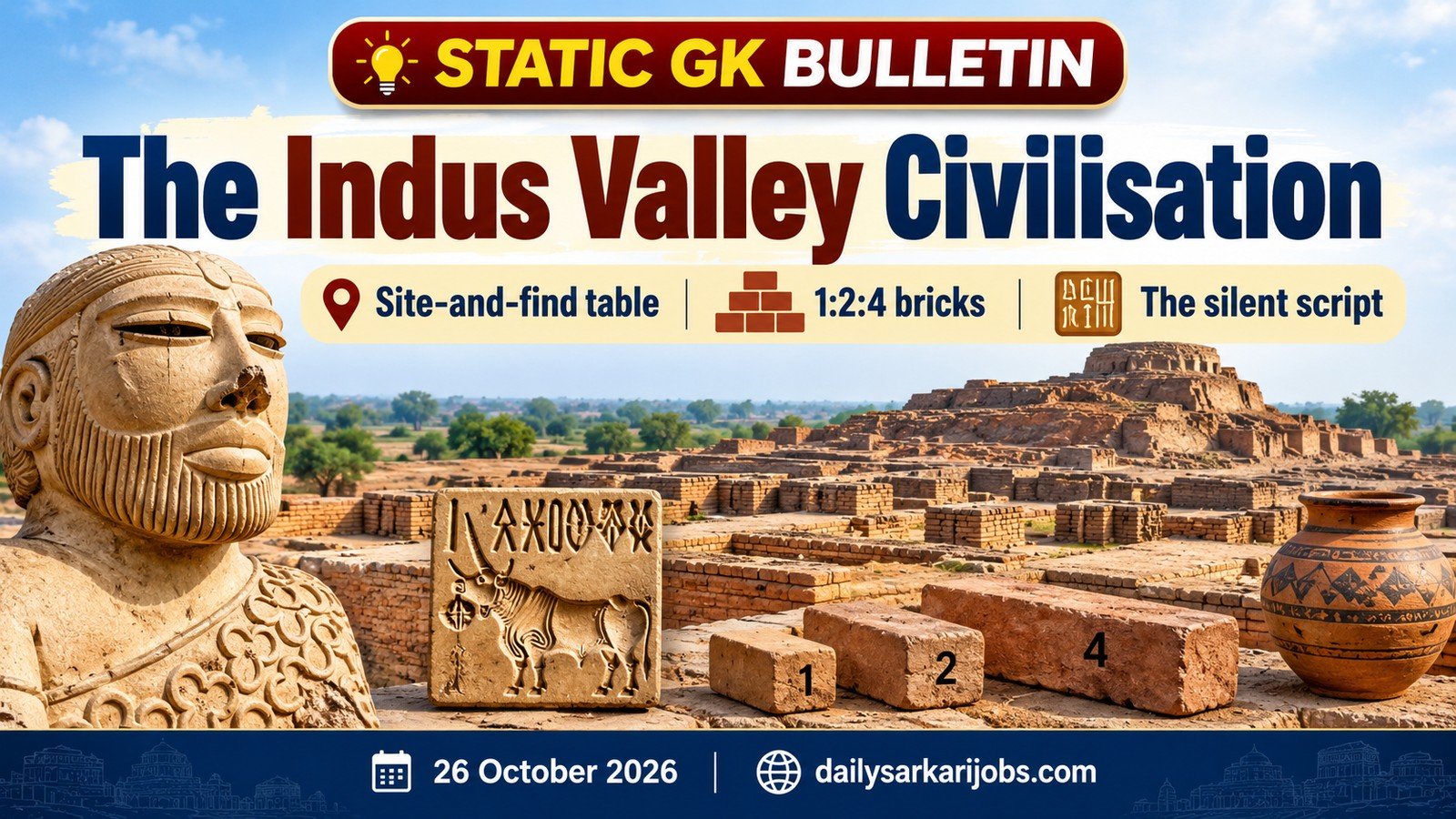
Almost every exam that tests ancient history tests the Indus Valley Civilisation, and almost every question takes the same shape: which site gave us which find? Candidates who try to memorise dates and rulers do badly here. Candidates who learn one table do well. This capsule explains why the questions are built that way, and then gives you the table.
⚡ QUICK FACTS
Also called
Harappan Civilisation
Mature phase
About 2600 BCE to 1900 BCE
First site excavated
Harappa, 1921
Known sites
More than 1,000
Script
Undeciphered
On the World Heritage List
Dholavira, inscribed 27 July 2021
The Hinge: a Civilisation Known from Its Drains, Not Its Kings
Here is the fact that explains the entire chapter. The Harappan script has never been deciphered. The Archaeological Survey of India still holds seminars with titles like Decipherment of the Indus Script: Current Status and Way Forward — which tells you plainly where the matter stands.
Now follow the consequence. For Egypt and Mesopotamia we can read the writing, so we know kings’ names, dynasties, wars and tax records. For the Harappans we can read nothing. Not one Harappan ruler’s name is known. There is no king list, no dated event, no battle. Everything we claim about this civilisation is inferred from things people left behind — bricks, drains, seals, weights, skeletons, grain.
So the exam asks what the evidence can actually answer. It cannot ask who ruled Mohenjo-daro. It can ask where the Great Bath is, which site had a dockyard, which site gave up a ploughed field. The question pattern is not laziness on the examiner’s part. It is the shape of the evidence.
Carry one more implication. Because the script is silent, a great deal of what you will read is interpretation, and some of it is disputed. We flag the live disputes below rather than hiding them, because a candidate who knows a claim is contested answers more carefully than one who has memorised it as settled.
The Timeline, in Three Phases
Phase
Roughly
What it means
Early Harappan
About 3300–2600 BCE
Villages, early pottery and crafts; no cities yet
Mature Harappan
About 2600–1900 BCE
The urban phase — planned cities, seals, standard weights, long-distance trade
Late Harappan
About 1900–1300 BCE
Cities decline, settlements shift east and south, urban features fade
If a question says “the Indus Valley Civilisation” without qualification, it almost always means the Mature Harappan phase. That is the phase of the planned city, and it places the civilisation in the Bronze Age — the National Museum notes that the classification rests on the number of objects made from copper-based alloys. Four Bronze Age civilisations existed at the same time in the third millennium BCE: the Indus, Egypt, Mesopotamia and China.
Jargon, defined once.BCE means Before Common Era, the same span as BC. Bronze Age means the period when people worked copper and its alloys but not yet iron — so remember that the Harappans did not know iron, a favourite one-mark question.
How It Was Found
The discovery sequence is short and is asked directly:
Harappa (now in Pakistan) was excavated in 1921 under Daya Ram Sahni.
Mohenjo-daro (now in Pakistan) was excavated in 1922 by R. D. Banerji.
Both worked under Sir John Marshall, then Director-General of the Archaeological Survey of India, who announced the discovery of a previously unknown civilisation to the world in 1924.
The civilisation is named after Harappa because Harappa was dug first — not because it was the largest or the capital. That is why “Harappan Civilisation” and “Indus Valley Civilisation” mean the same thing, and why the second name is now considered less accurate: many sites, including the biggest ones in India, are nowhere near the Indus.
The Site-and-Find Table
This is the table. Learn it in the direction the exam asks — given the find, name the site — because that is how the options are written.
Site
Where it is
What it is known for
Harappa
Punjab, Pakistan
First site excavated (1921); granaries; the cemetery known as R-37
Mohenjo-daro
Sindh, Pakistan
The Great Bath; the Great Granary; the bronze Dancing Girl; the steatite bearded figure often called the Priest-King
Dholavira
Kutch, Gujarat
Stone-cut water reservoirs; a three-part city; the ten-sign signboard; India’s 40th World Heritage Site
Lothal
Gujarat
The large brick basin widely identified as a dockyard; a warehouse; bead-making
Kalibangan
Rajasthan
A ploughed field — the earliest known anywhere; fire altars
Rakhigarhi
Hisar, Haryana
Described by ASI as the largest Harappan site in the Indian subcontinent, over 350 hectares
Chanhudaro
Sindh, Pakistan
Bead-making workshops; notable for having no citadel
Banawali
Haryana
Barley; a toy plough; a lack of the usual grid drainage
Surkotada
Gujarat
Remains claimed as horse bones — disputed
Daimabad
Maharashtra
The bronze chariot — a Late Harappan site, and the southernmost
Three pairs cause most of the lost marks. Lothal and Chanhudaro were both bead-making centres, but only Lothal has the basin. Kalibangan and Banawali both gave up agricultural evidence, but the ploughed field is Kalibangan and the toy plough is Banawali. And both Mohenjo-daro and Harappa had granaries — only Mohenjo-daro has the Great Bath.
Dholavira: the One Site With an Official Dossier
Dholavira is worth separating out, because it is the Harappan site India has documented most formally. It was inscribed on the UNESCO World Heritage List on 27 July 2021 as India’s 40th World Heritage Site, which at that point gave India 32 cultural, 7 natural and 1 mixed property.
The official description is itself exam material. Dholavira dates from the third to the mid-second millennium BCE, with the earliest evidence from about 3000 BCE, and the city was occupied for roughly 1,500 years. The property has two parts, a walled city and a cemetery to its west, and the walled city contains a citadel, a bailey, a ceremonial ground, a middle town and a lower town.
Water is the point of Dholavira. It sits in an arid part of Kutch, and the inhabitants collected water from seasonal streams, scanty rain and the ground, storing it in large stone-cut reservoirs along the eastern and southern fortifications, with rock-cut wells including one inside the citadel.
And now the trap. Dholavira is often described as the largest Harappan site in India, which is why candidates pick it when a question asks for the largest. The official inscription material describes Dholavira as the sixth largest of more than 1,000 known Harappan sites, while ASI describes Rakhigarhi as the largest in the Indian subcontinent. Read the words of the question: “largest in India”, “largest excavated” and “largest in the subcontinent” are not the same question. Our capsule on India’s UNESCO World Heritage Sites sets out how inscription works and why the count moves.
Town Planning: What Was Standardised
The thing that makes Harappan cities remarkable is not their size. It is that cities hundreds of kilometres apart were built to the same specifications:
A grid layout — main streets running roughly north-south and east-west, crossing at right angles.
A two-part city — a raised citadel on the west and a lower town to the east, which at Dholavira becomes three parts.
Covered drains along the streets, with house drains feeding into them and inspection holes for cleaning — the most advanced drainage of the ancient world.
Baked bricks in a fixed ratio of 1:2:4 (thickness : width : length), used from Gujarat to Punjab.
Granaries, public wells and bathrooms in ordinary houses, with houses opening onto side lanes rather than the main street.
The brick ratio is the single best fact in this chapter, and here is why it beats any list of city names. A standard brick size across a thousand kilometres means a shared system of measurement, shared training, and some authority able to make it stick — without which you cannot get the drains to work either. One ratio proves the existence of an administration whose name we will never know.
Seals, the Script and the Weights
Seals were usually made of steatite (soapstone), squarish, carved with an animal and a short line of signs. The most discussed is the Pashupati seal from Mohenjo-daro, showing a seated figure surrounded by animals.
The script runs right to left. Longer inscriptions can be boustrophedon — the next line reverses direction, the way an ox turns at the end of a furrow. Inscriptions are very short, usually five signs or so, which is a large part of why decipherment has failed.
Weights were cubical, usually of chert, and followed a binary system in the lower denominations — doubling from a small unit — moving to decimal multiples at the higher end. The weights carry no markings.
The unicorn-like one-horned animal is the commonest motif on seals; the humped bull is also frequent. There is no agreed depiction of a horse from the Mature phase, which is why the Surkotada claim is argued over.
Why does an undeciphered script still earn marks? Because the askable facts about it are physical, not linguistic: its direction, its brevity, the material of the seals, the animals on them. You are never asked what it says.
Why It Declined, and What a 2026 Study Adds
There is no single agreed reason for the end of the urban phase, and the honest answer names several: climate change and weakening rainfall, the drying or shifting of rivers, deforestation and soil exhaustion, a decline in trade with Mesopotamia, and floods. The older textbook idea of an Aryan invasion destroying the cities is no longer accepted by most archaeologists.
The climate explanation now has Indian government science behind it. The Birbal Sahni Institute of Palaeosciences, an autonomous institute of the Department of Science and Technology, studied a sediment core from Deoria Tal, a lake in the Garhwal Himalaya. Pollen in the core shows an abrupt change around 4250 years before present, matching the short dry episode known as the 4.2 ka event.
The researchers read it this way: a weak Indian Summer Monsoon from roughly 5100 to 4000 years ago made the seasonal flooding of the Indus and Ghaggar-Hakra unreliable, and people moved towards the eastern Ganga plains. In other words, the civilisation did not vanish — it relocated and de-urbanised. That matches the Late Harappan picture of settlements shifting east and south.
Jargon, defined once.4.2 ka event means an episode about 4,200 years ago (ka = thousand years); it is recognised worldwide. Ghaggar-Hakra is a seasonal river system in north-west India and Pakistan, which many identify with the Saraswati of the texts — an identification that is itself debated. Our capsule on Rivers, Dams and Lakes of India places these rivers on the map.
The Live Disputes, Named
Three claims in this chapter are genuinely argued over by specialists. Knowing which they are is more useful than pretending they are settled.
The claim
The state of the argument
Lothal’s basin was a dockyard
S. R. Rao argued the large trapezoidal basin, with its inlet and outlet channel and nearby warehouse, was a dockyard. Others, notably L. S. Leshnik, read it as a water reservoir and doubted sea access. A 2024 study from IIT Gandhinagar mapped more than 140 old river channels and showed the Sabarmati once ran past Lothal, which supports the dockyard reading — but the question is not formally closed.
The horse was known to the Harappans
Bones from Surkotada have been identified by some as domesticated horse and by others as wild ass or half-ass. There is no undisputed horse on a seal from the Mature phase.
The largest Harappan site
ASI describes Rakhigarhi as the largest in the Indian subcontinent; the World Heritage material calls Dholavira the sixth largest of over 1,000 sites. The answer depends on the exact wording of the question.
Why a Reader Should Care
The Indus Valley Civilisation is the first chapter of ancient history in almost every syllabus, and it is tested in every tier — SSC CGL and CHSL, Railways, Banking general awareness, State PCS prelims and the UPSC prelims. It is also one of the few history topics where the facts do not change, so the effort you put in once keeps paying.
The efficient way to revise it is the way this capsule is built: one hinge (the script is silent, so the evidence is material), one table (site to find), one ratio (1:2:4) and the three disputes. If you are revising the broader history track, our capsule on the Indian National Movement covers the modern end of the same syllabus, and the capsule on Classical Dances, Folk Dances and Festivals covers the culture section that sits beside it.
Today’s Current Affairs capsule is on a very different list — India’s Ramsar Sites reaching 103. Read the two together and you will notice the same examiner’s habit in both: the list is what candidates memorise, and the system behind the list is what gets asked.
Practice Questions
Q1. Dholavira was inscribed on the UNESCO World Heritage List in which year? (a) 2016 (b) 2019 (c) 2021 (d) 2023 Answer: (c) 2021 The inscription came on 27 July 2021, making it India’s 40th World Heritage property.
Q2. Which Harappan site gave archaeologists the earliest known ploughed field and a set of fire altars? (a) Banawali (b) Kalibangan (c) Lothal (d) Surkotada Answer: (b) Kalibangan Banawali is the near-miss option: it produced a toy plough, not a ploughed field.
Q3. The Archaeological Survey of India describes which site as the largest Harappan site in the Indian subcontinent? (a) Mohenjo-daro (b) Dholavira (c) Harappa (d) Rakhigarhi Answer: (d) Rakhigarhi It spreads over more than 350 hectares in Hisar district, Haryana. Dholavira is separately described in the World Heritage material as the sixth largest of over 1,000 known sites.
Q4. Which statement about the Harappan script is correct? (a) It is written left to right and has been deciphered (b) It is written right to left and remains undeciphered (c) It is a syllabic script read only on copper plates (d) It was deciphered in 1924 by Sir John Marshall Answer: (b) It is written right to left and remains undeciphered Marshall announced the civilisation’s discovery in 1924; he did not read its writing, and nobody has since.
Q5. Baked bricks in Harappan cities followed a standard ratio of: (a) 1:2:3 (b) 1:2:4 (c) 1:3:5 (d) 2:3:4 Answer: (b) 1:2:4 Thickness to width to length. The same proportion turning up from Gujarat to Punjab is the strongest single piece of evidence for a shared system of administration.
30-Second Revision
The script is undeciphered and no ruler is named, so everything known comes from material remains — which is why exams ask site-and-find rather than kings and dates. Mature phase: about 2600–1900 BCE, a Bronze Age civilisation with no iron.
Site to find: Great Bath and Dancing Girl at Mohenjo-daro; reservoirs and the signboard at Dholavira; the dockyard basin at Lothal; ploughed field and fire altars at Kalibangan; bronze chariot at Daimabad; no citadel at Chanhudaro.
Bricks in a 1:2:4 ratio across a thousand kilometres prove a shared administration. Dholavira = India’s 40th World Heritage Site, 27 July 2021. Decline: climate, not invasion — the 4.2 ka dry event and a weak monsoon, per the Birbal Sahni Institute’s 2026 pollen study.
Sources
Press Information Bureau, India gets its 40th World Heritage Site (Dholavira, July 2021) — the inscription date, the site’s two parts and five divisions, the occupation span, the water reservoirs and the sixth-largest description.
Press Information Bureau / Department of Science and Technology, Pollens help trace why the Harappan Civilization shrank — the Birbal Sahni Institute of Palaeosciences study of the Deoria Tal core, the 4.2 ka event and the eastward migration.
National Museum, New Delhi, Harappan Civilization gallery notes — the Bronze Age classification, the bronze Dancing Girl and the list of principal sites.
Archaeological Survey of India — Rakhigarhi’s size and identification, and the standing status of Indus script decipherment.
Gupta, Prabhakar and Jain (2024), on the palaeochannels around Lothal — the study supporting the dockyard reading.